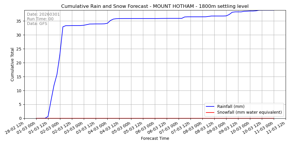
Snow Depth Forecast by Site
Estimated cumulative snowfall (converted from precipitation) at key snow-prone sites for multiple snow settling thresholds.
This page shows site-based snowfall depth accumulation forecasts, calculated only where snow is likely to settle based on atmospheric conditions. Forecasts are generated using a custom model I developed through long-term observation and data analysis, linking 850 hPa temperature with elevation-based settling thresholds.
Snowfall estimates are based on cumulative precipitation from the latest GFS model run and updated automatically twice a day.
- 📍 Forecasts currently available for: Perisher, Thredbo, Hotham, Falls Creek, Buller, Ben Lomond, and Mount Mawson.
- 🔄 Fully automated updates from the latest GFS data, twice daily. Each site assessed at 4 different levels.
- 📊 Blue line: cumulative rainfall • Magenta line: cumulative snowfall (10-day outlook).
- 🔒 Additional sites available to members — including the Blue Mountains, Mt Wellington, and the Northern Tablelands.
- ✨ Subscribers can request new locations for inclusion.
Extended access is $50/year. No marketing, no commentary — just model-based forecasts updated in the background.
Perisher


Thredbo


Mount Hotham


Falls Creek


Mount Buller


Ben Lomond


Mount Mawson


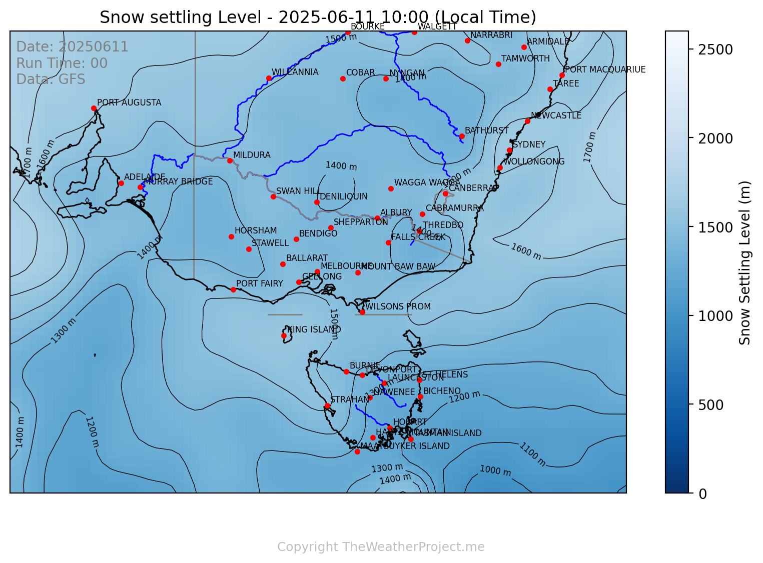
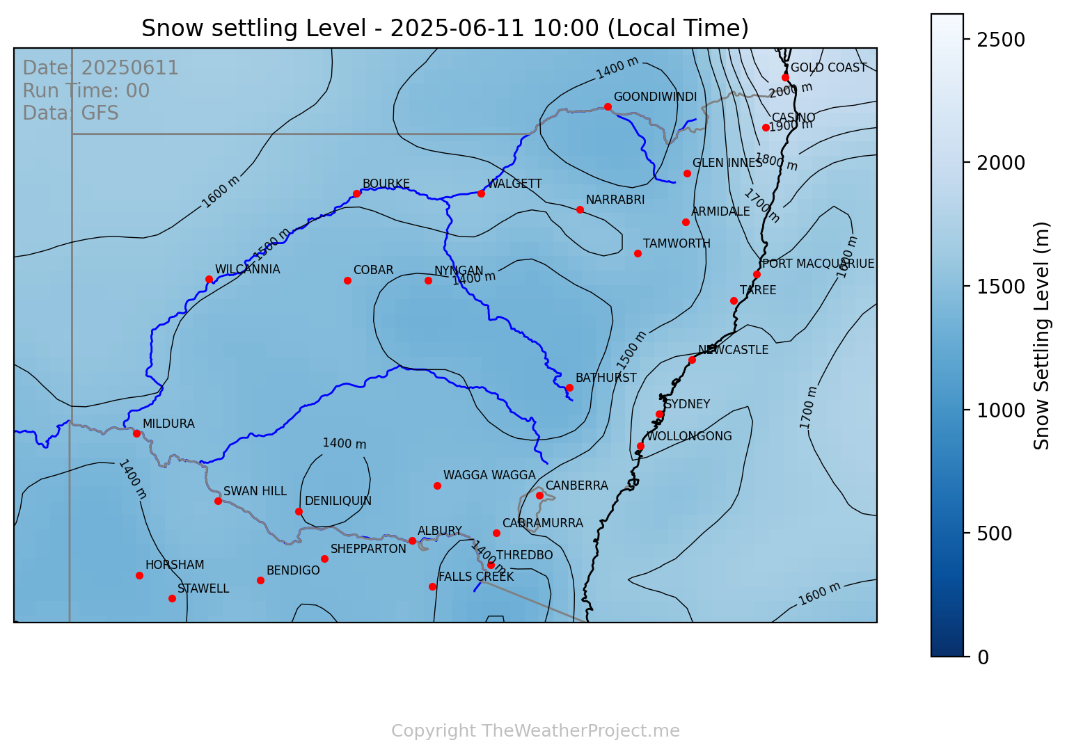
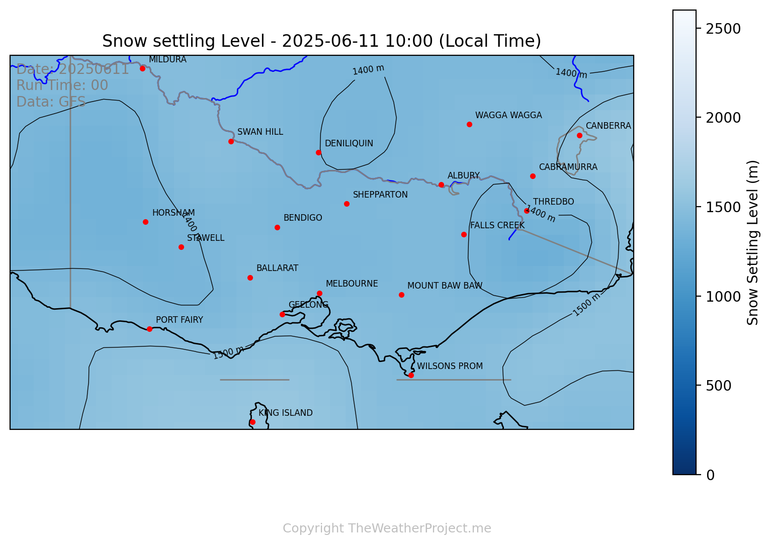
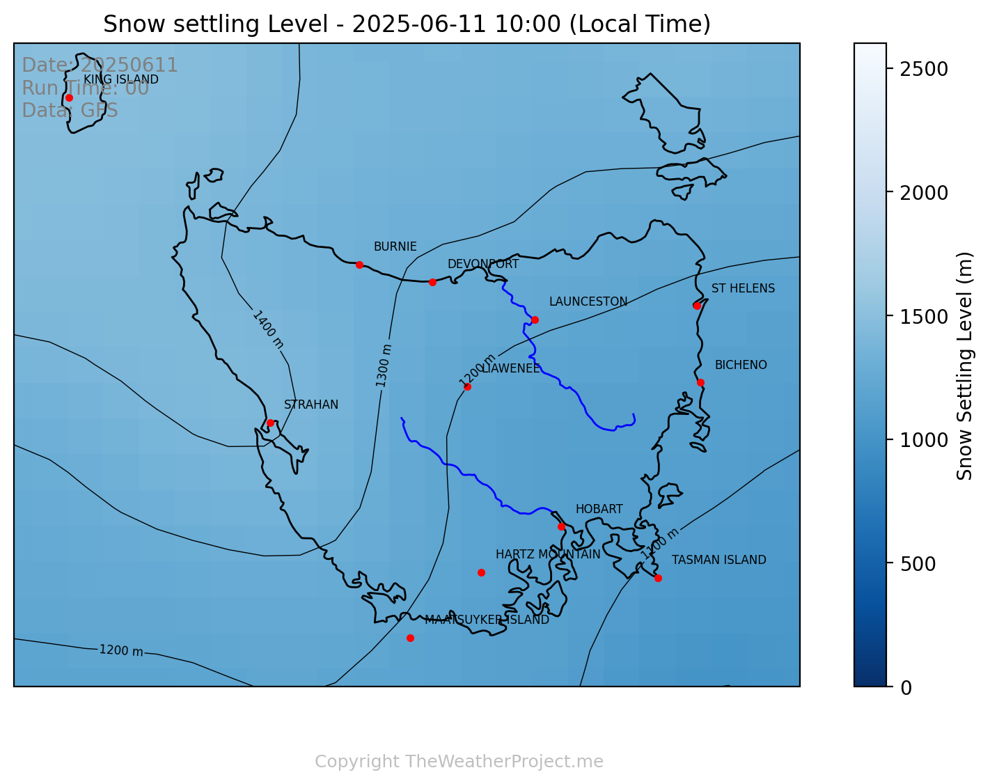
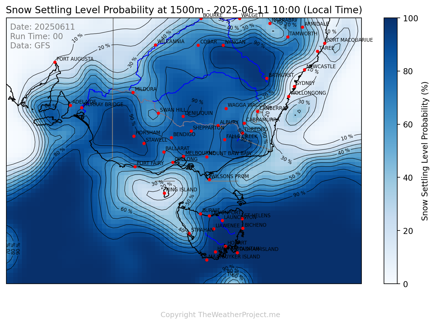
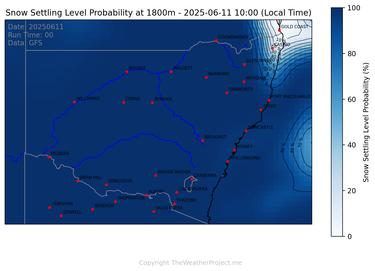
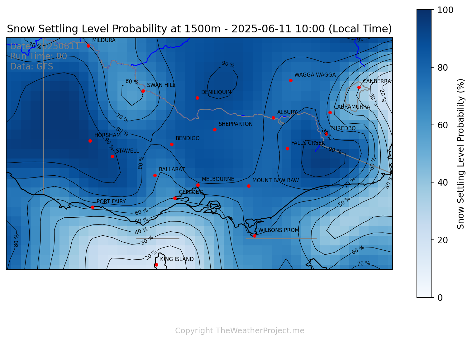
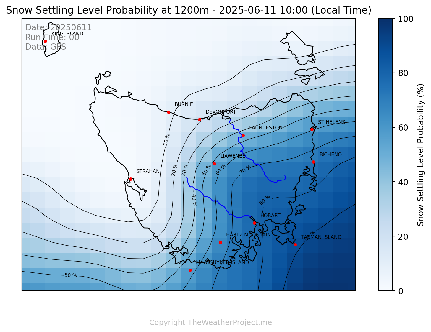
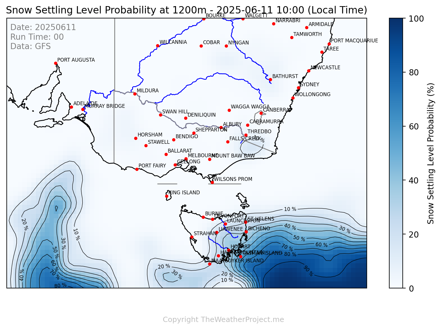
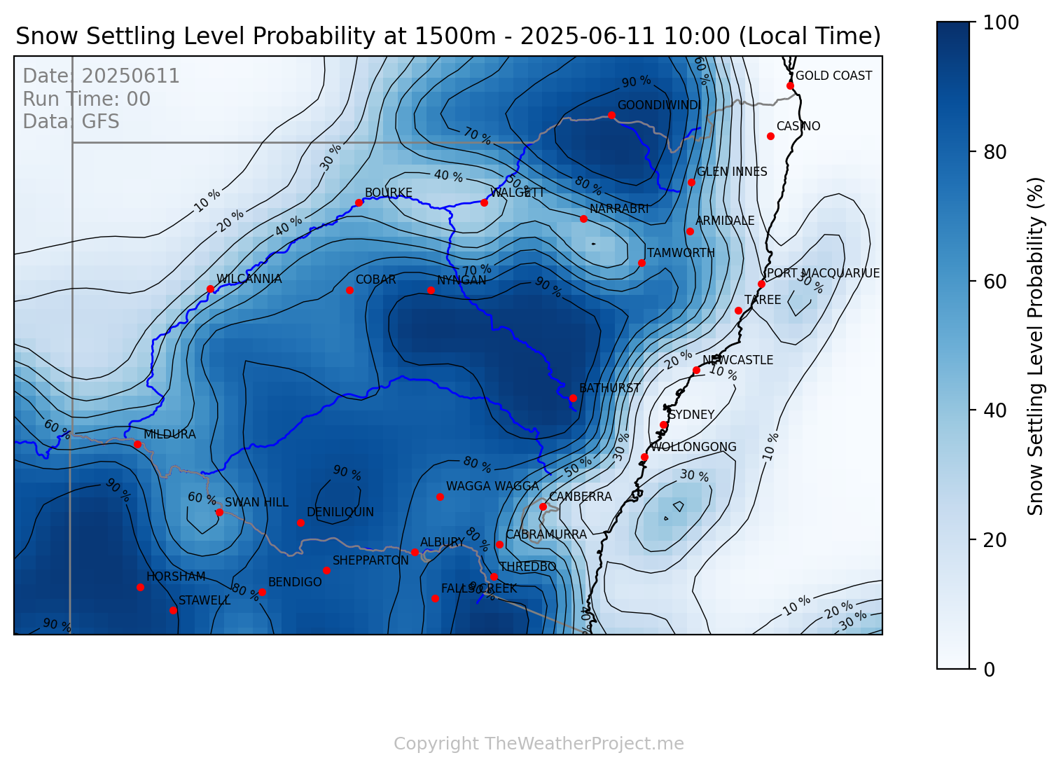
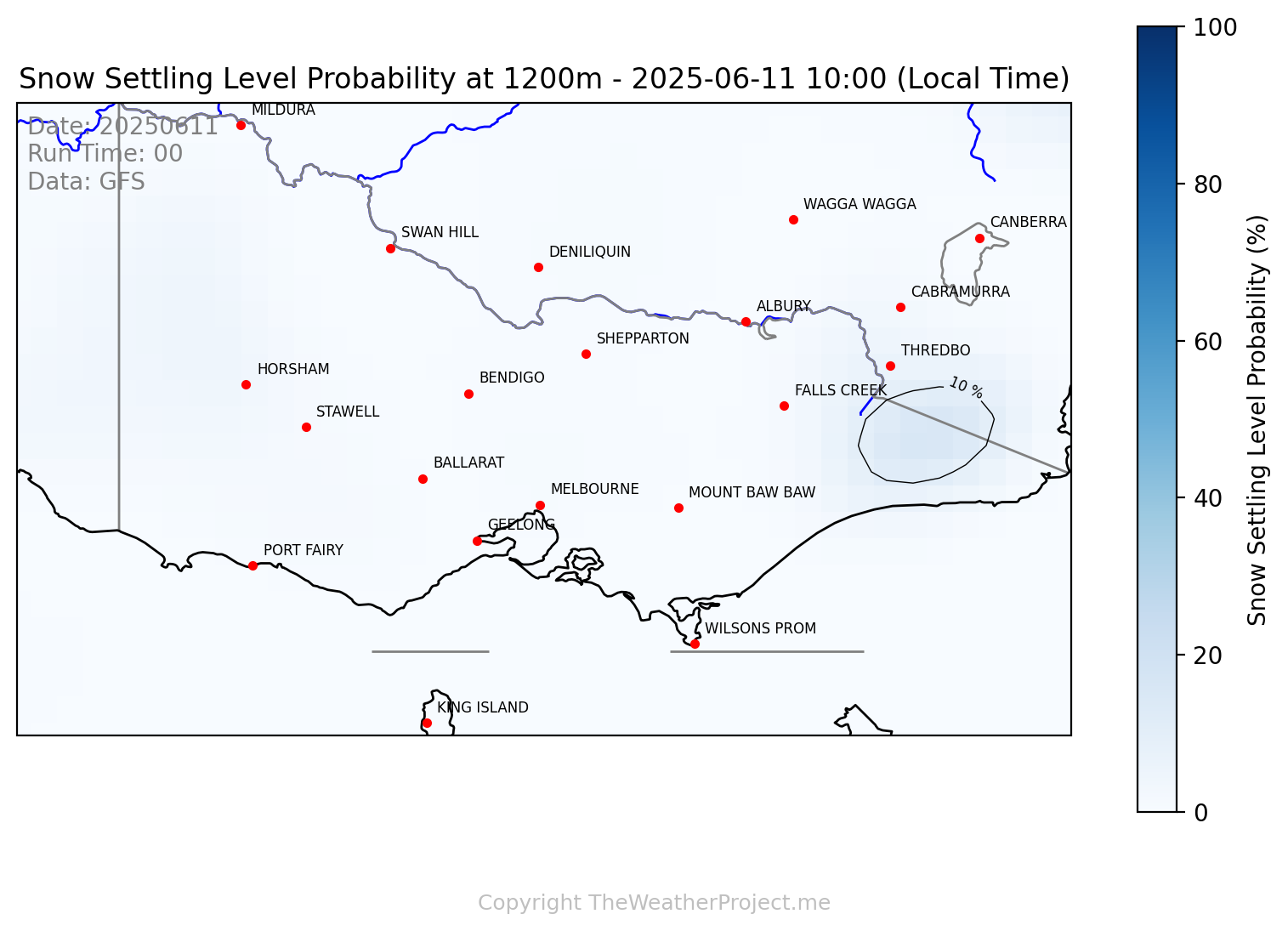
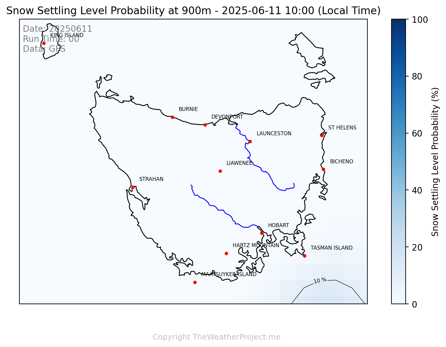
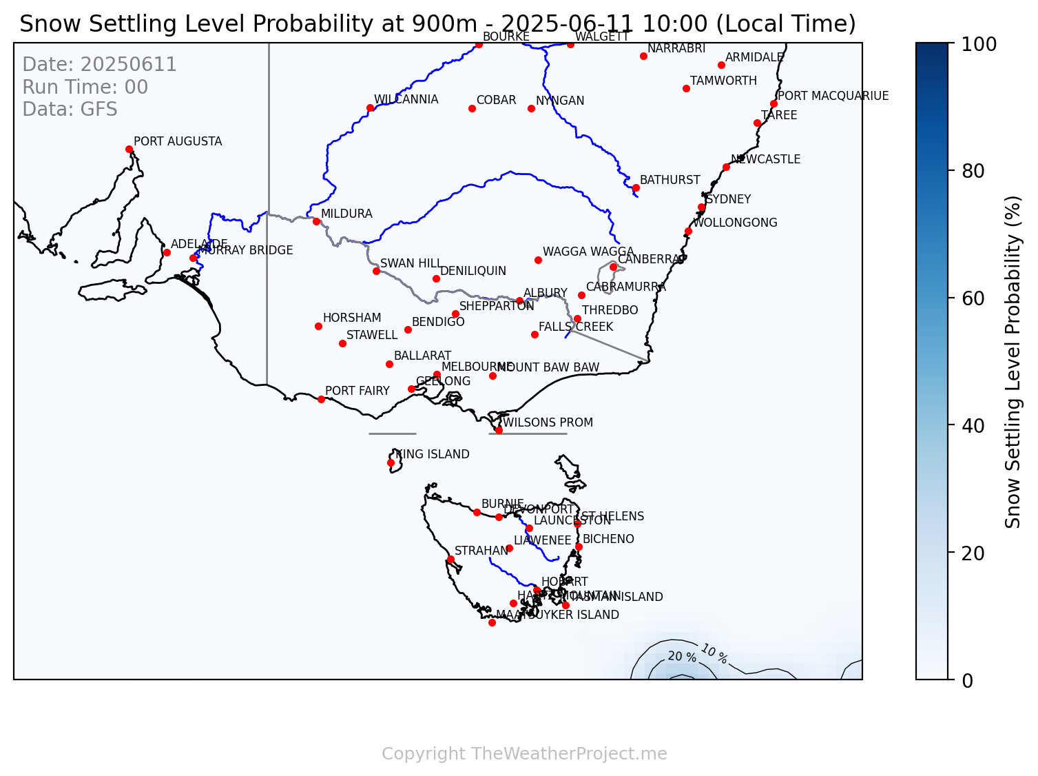
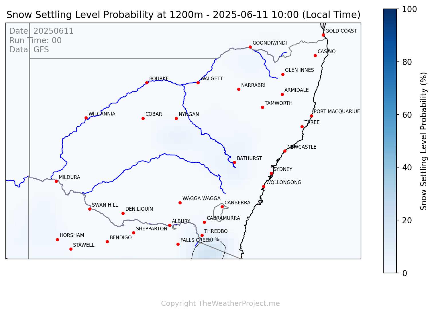
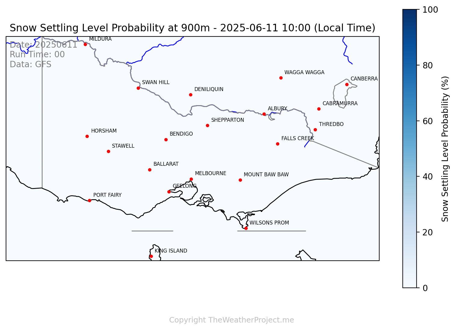
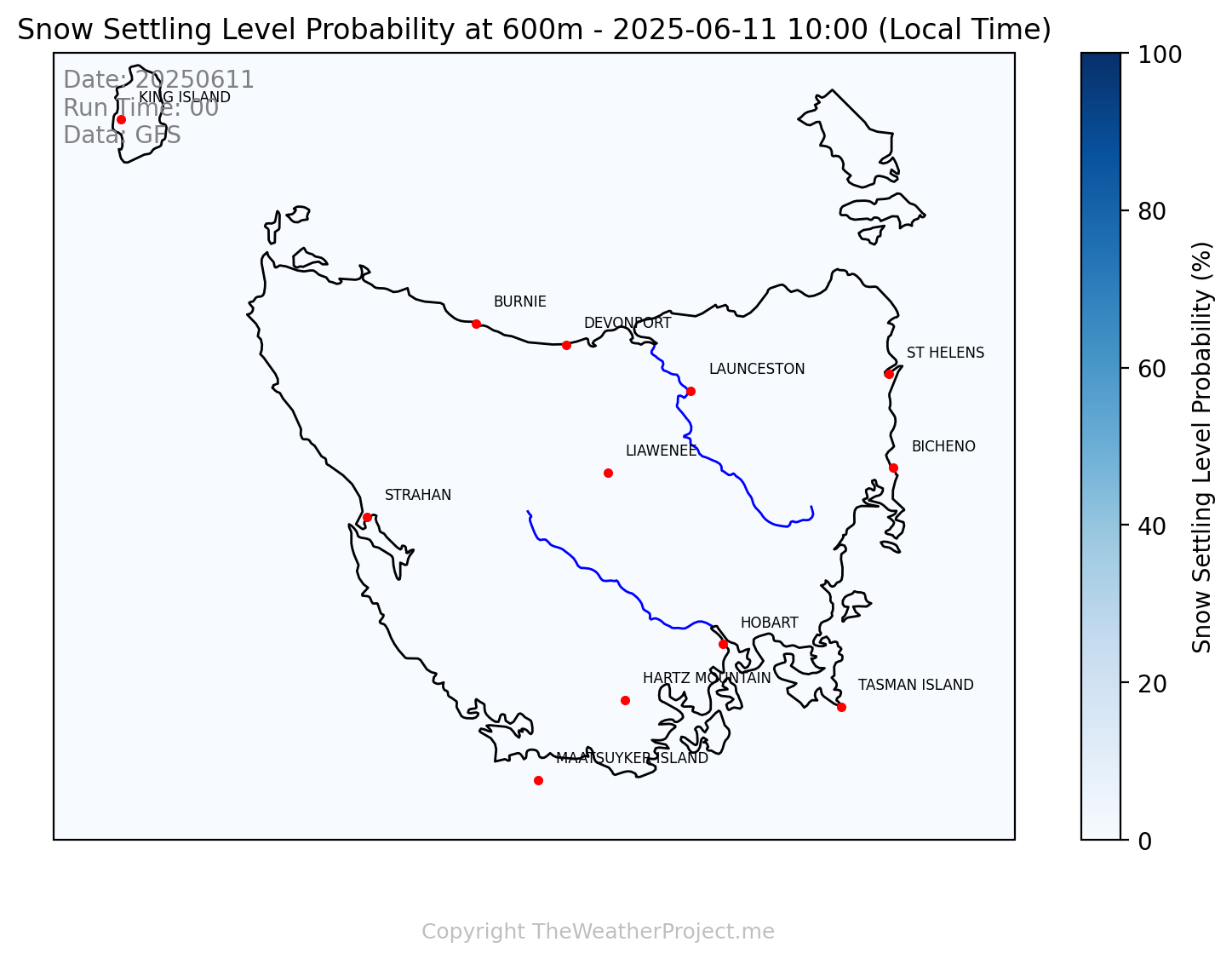
Snow Settling Level Forecast
Forecast shows the altitude at which snow is likely to settle – based on atmospheric temperature and elevation relationships.
This forecast shows where snow is **likely to settle** if it falls and the conditions present or required for snow to fall. It’s derived from years of observing snow settling level in relation to the 850 hPa temperature and geopotential height, then mapped using GFS model data.
4-day outlook available from the menus above, subscribe for access to the 10 day outlook, forecast snow depths coming soon
What These Maps Show:
- ✅ Forecast snow settling level by location
- ✅ A measure of whether it is cold enough for snow and if so, to what level
- ✅ The probability of snow settling at different levels - maps vary by region. Again, indicative of the liklihood of it being cold enough, this doesn't consider whether it'll rain/snow
Use this to plan ski trips, travel, hikes, and snow chasing opportunities — especially in borderline events where elevation matters.
South East Aus
New South Wales
Victoria
Tasmania
Access Full Coverage
See snow forecast projections for VIC, NSW, TAS, SE Australia, — forecast every 3 hours out to 10 days.
Login or Subscribe