
The Weather Project · Agricultural guidance
Agricultural Weather Explorer
Explore spraying conditions, livestock heat stress, crop development and reference evapotranspiration across Australia. Step through the next 36 forecast hours, or choose a daily agricultural product.
Delta-T
The difference between air and wet-bulb temperature, shown in degrees Celsius.
Tasmania · 3-hourly forecastA complete local calendar day. This is a daily total, not a 3-hourly forecast.
Whole forecast run · 0–240-hour model samples. This summary is not restricted to the 36-hour viewer window.
Tasmania · Delta-T · forecast lead +0 hours
Open original map ↗Understanding this agricultural product
Daily PDF forecasts · Your nominated location
Your site. Two forecast models. One practical daily report.
Spend less time piecing together weather apps and more time planning the week. Our daily site forecast PDFs bring the local outlook, GFS and ECMWF AIFS comparisons, and recent forecast changes into one report you can save, print or share with your team.
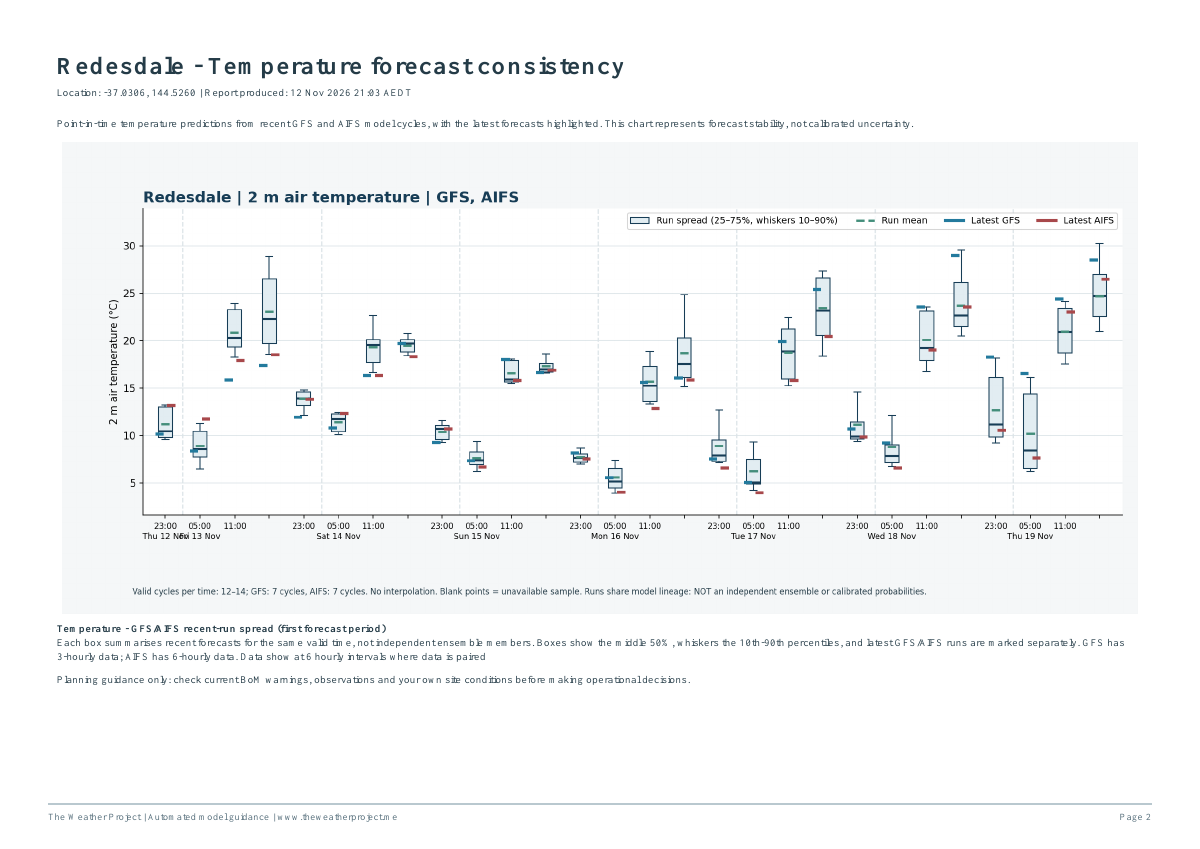
See where the models agree, where they differ, and whether the outlook has been holding steady or shifting between runs. Nominate your farm, vineyard, orchard or other site by latitude and longitude; we confirm the location before setting up your report.
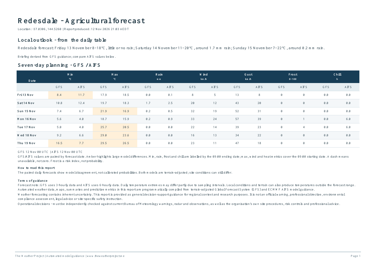
For growers and agricultural planning · 6-page sample
Daily agricultural forecast PDF
Bring the weather outlook and practical agricultural metrics to the same planning conversation, from overnight frost monitoring to crop development and evaporative demand.
- A useful daily overview: paired minimum and maximum temperatures, rain, wind, gusts, frost index and chill hours.
- Crop and water-demand context: growing degree-days and reference evapotranspiration (ETo), plus daytime Delta-T, humidity, wind and cattle heat-stress metrics.
- See how the outlook is evolving: temperature forecast consistency, daytime and overnight rainfall charts, and overnight frost-index charts.
- Regional context: Delta-T and ETo maps alongside your site report, with their own valid times.
For a closer look at local weather · 9-page sample
Expanded daily weather forecast PDF
A more detailed view for people whose plans depend on several weather factors. Follow changing temperature, rain, wind and moisture conditions without rebuilding the picture from separate charts.
- Your week at a glance: a concise outlook and paired GFS/AIFS daily planning table.
- Rain and frost detail: 12-hour rainfall outlooks and overnight frost-index charts.
- More forecast detail: temperature, wind speed, gust, dewpoint, wet-bulb temperature and relative-humidity charts.
- Latest runs in context: recent forecast-cycle spread with the latest model forecasts highlighted, helping you recognise a stable signal or a changing outlook.
Daily PDFs are a site-report service; portal-only access does not include a daily PDF. Ask us which report format suits your location and needs. Forecast-run spread shows model consistency, not calibrated probabilities. Frost scores are indices, not percentages. Reference ETo is not an irrigation prescription, and Delta-T does not establish approval to spray. Use official warnings and local observations alongside this guidance.
Sample annotation: the agricultural metrics page carries a New South Wales source-region label for this Victorian site; the sample is reproduced as supplied and this label is under review. Regional maps are separate context, not the site forecast.